Impact figures with a map of project sitesimpact-counters-map
Use in Plus UI
npx shadcn@latest add https://blocks.plusui.com/r/impact-counters-map.jsonStats · 13 variants
← → to step through · + on a thumbnail to compare side by side (up to 3)
‹
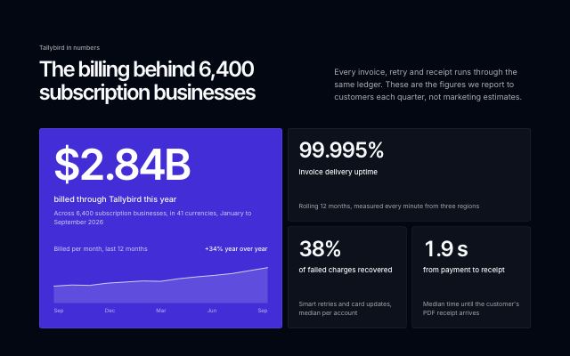 Inverted bento with a hero metric+
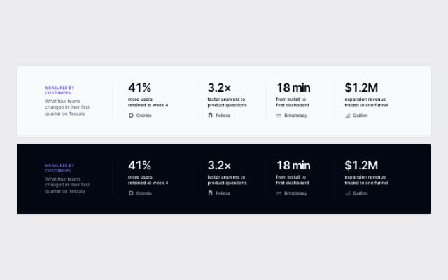 Inline proof band under a hero+
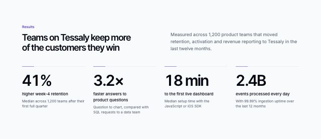 Metric band with sourced numbers+
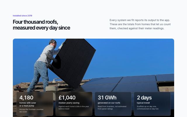 Figures over a full-bleed photo+
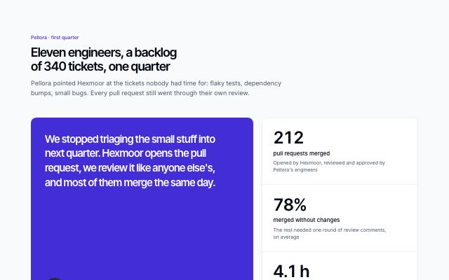 Metrics beside a customer quote+
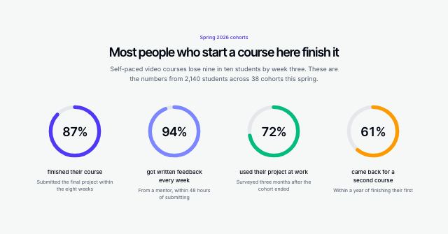 Metrics as progress rings+
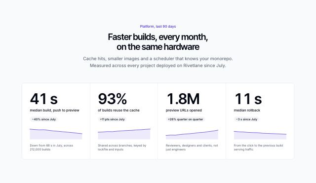 Big numbers with sparklines+
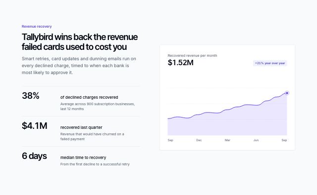 Metrics beside a trend chart+
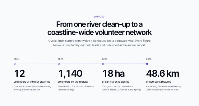 Growth milestones on a timeline+
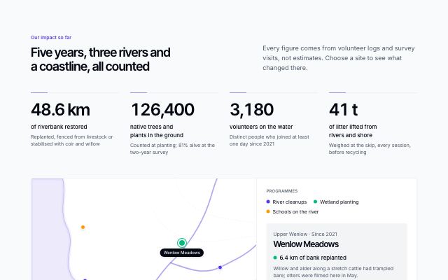 Impact figures with a map of project sites
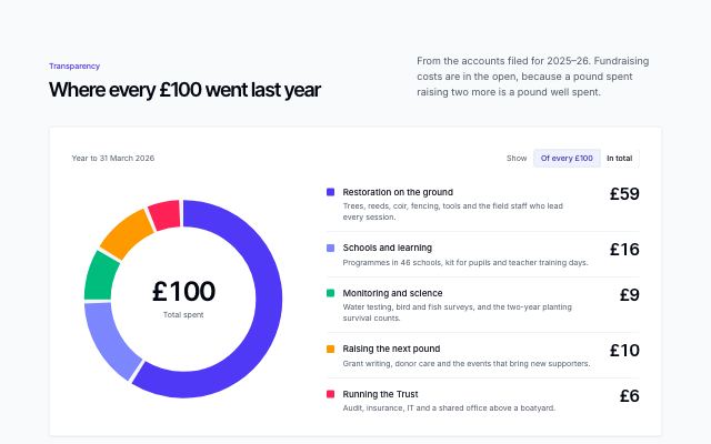 Where the money goes+
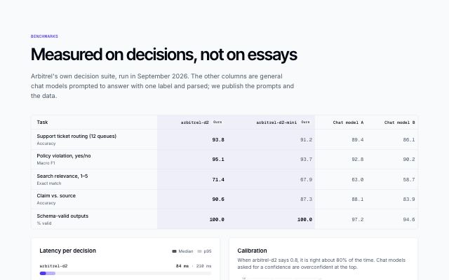 Model benchmarks with latency and calibration+
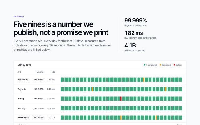 Reliability ledger with daily uptime bars+
/preview/impact-counters-map
Open ↗Default content
{
  "eyebrow": "Our impact so far",
  "title": "Five years, three rivers and a coastline, all counted",
  "description": "Every figure comes from volunteer logs and survey visits, not estimates. Choose a site to see what changed there.",
  "figures": [
    {
      "value": "48.6 km",
      "label": "of riverbank restored",
      "context": "Replanted, fenced from livestock or stabilised with coir and willow"
    },
    {
      "value": "126,400",
      "label": "native trees and plants in the ground",
      "context": "Counted at planting; 81% alive at the two-year survey"
    },
    {
      "value": "3,180",
      "label": "volunteers on the water",
      "context": "Distinct people who joined at least one day since 2021"
    },
    {
      "value": "41 t",
      "label": "of litter lifted from rivers and shore",
      "context": "Weighed at the skip, every session, before recycling"
    }
  ],
  "period": "April 2021 to March 2026. Survey method and raw logs are in the annual report.",
  "map": {
    "label": "Map of Ovelle Trust project sites",
    "legendLabel": "Programmes",
    "programs": [
      "River cleanups",
      "Wetland planting",
      "Schools on the river"
    ],
    "sitesLabel": "Project sites",
    "sites": [
      {
        "id": "wenlow-meadows",
        "name": "Wenlow Meadows",
        "region": "Upper Wenlow",
        "program": 1,
        "x": 67,
        "y": 29,
        "result": "6.4 km of bank replanted",
        "since": "Since 2021",
        "detail": "Willow and alder along a stretch cattle had trampled bare; otters were filmed here in May."
      },
      {
        "id": "ashby-brook",
        "name": "Ashby Brook",
        "region": "Hollin Valley",
        "program": 0,
        "x": 84,
        "y": 40,
        "result": "9.1 t of litter removed",
        "since": "Since 2022",
        "detail": "Monthly cleanups below the town bridge; trout counts have doubled since the first survey."
      },
      {
        "id": "tamsin-marsh",
        "name": "Tamsin Marsh",
        "region": "Tamsin Estuary",
        "program": 1,
        "x": 42,
        "y": 60,
        "result": "18 ha of saltmarsh replanted",
        "since": "Since 2021",
        "detail": "Cordgrass and sea lavender plugs on a marsh that was losing two metres a year to the tide."
      },
      {
        "id": "carrick-sands",
        "name": "Carrick Sands",
        "region": "Brackmoor Coast",
        "program": 0,
        "x": 24,
        "y": 46,
        "result": "14.8 t lifted from the strandline",
        "since": "Since 2022"
      },
      {
        "id": "millrace-school",
        "name": "Millrace Primary",
        "region": "Hollin Valley",
        "program": 2,
        "x": 66,
        "y": 70,
        "result": "1,240 pupils at the river",
        "since": "Since 2023",
        "detail": "Every Year 5 class spends four mornings a year testing water and planting the school's own bank."
      },
      {
        "id": "hollin-ford",
        "name": "Hollin Ford",
        "region": "Hollin Valley",
        "program": 1,
        "x": 77,
        "y": 81,
        "result": "2.3 km of reed bed planted",
        "since": "Since 2024"
      },
      {
        "id": "gullhaven",
        "name": "Gullhaven",
        "region": "Brackmoor Coast",
        "program": 2,
        "x": 23,
        "y": 22,
        "result": "640 pupils on the shore",
        "since": "Since 2024"
      }
    ]
  }
}